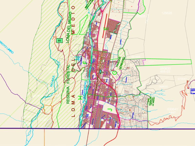
Location Map of the City of Tacna; includes towns, urban areas, and major highways.
Drawing labels, details, and other text information extracted from the CAD file (Translated from Spanish):
pampa la yarada, The sticks, linea ferrea tacna arica, Pan-American highway, the yarada, the olive trees, mouth of the river, village village, the huayco, The hit, kg, the band, miraflores, tomasiri, poquera, berlin, good view, the yaras, big sama, tacna, lane, pachia, the risk, huaycuyo, micula, hot, chuck, challange, tocuco, huanune boy, yarascay, coruca, big sambalay, Saint Rose, yarahuay, Pan-American highway, charipujo, muruhuyo, the wit, stage, causal, chulpapalca, ataspaca, caplina, touch, white lagoon, high turkey, anarch, chontacollo, paucarani, anchochulpa, senja, lagoon, coparaja, lagoon condorp, lagoon, i numa, lagoon, quasi, ocean, peaceful, moquegua, Chile, bolivia, sama, incline, high, of the, alliance, pachia, city, new, pocollay, crnl. gregory, apology, tacna, lane, stage, tarata, jorge basadre, lanchipa, political delimitation, district boundary, capital districts, population centers, administrative of the province, province boundary, capital department, international limit, legend, puerto grau, God’s city, graphic scale, candarave, rio sama, study, description, sheet, dad, saint, Pedro, erotic, ciu, National Institute, home construction, ministry of transport communications, developmental, urban