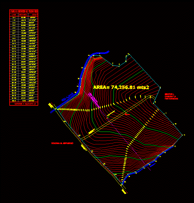
Contours; land on the south coast of Guatemala; with topographic brand notebook and banks including .
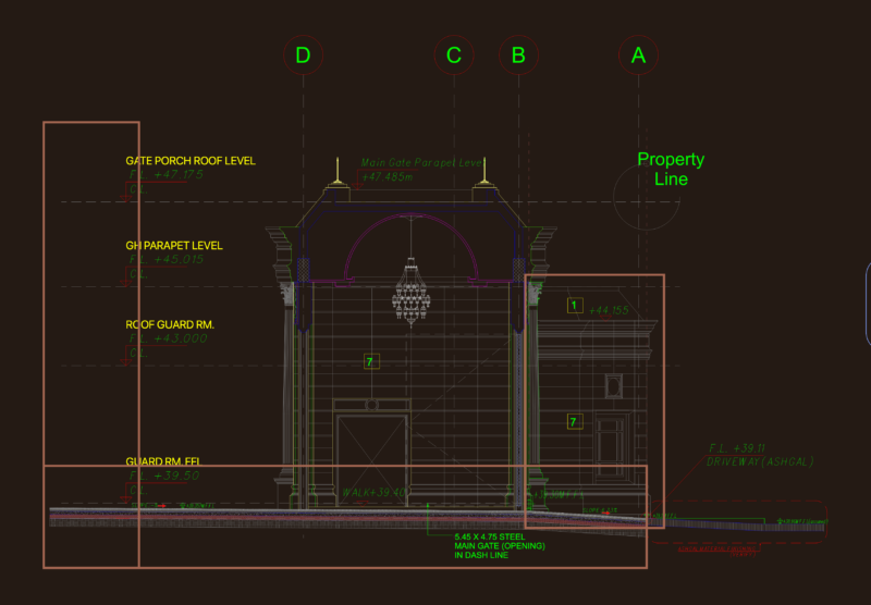
Drawing labels, details, and other text information extracted from the CAD file (Translated from Spanish):
in this sheet :, leaf number :, vo. bo. Owner:, vo. bo. ing. civil :, location :, calculated:, drew :, scale :, date :, planned :, colonia fraternity, san felipe, retalhuleu, red rudy, plane of level curves, rose :, ultra, plus, modern solutions in construction, finca matrix, sector i, caserio la fraternidad, rio hilario galindo, existing high tension, electric line, bm, paved street, los ángeles, towards cantón, san felipe, towards centro, retalhuleu, ajaxá river, stream, colonia, effort of construction of the physical polygon, side, distance, azimuth, high voltage post, general plan, – topographical plan, plans of:, sheet no., Observations :, professor :, arq., est., inst., date, plan topographical, – red rudy, drawing: