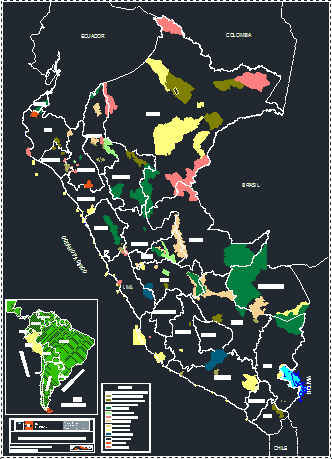
2D AutoCAD map of Peru illustrating the Protected Natural Areas (ANP) based on SERNARP and INEI data. The drawing contains vector boundaries for departmental divisions and color-coded zones identifying national parks, protection forests, wildlife refuges, and national sanctuaries. It includes an inset map of South America and a categorized legend for regional, private, and national administration zones. Mapa de Áreas Naturales Protegidas.
Peru Protected Natural Areas Map DWG