Map of the province of Puerto Plata. Dominican Republic.
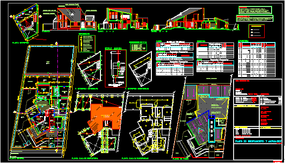
Drawing labels, details, and other text information extracted from the CAD file (Translated from Spanish):
puerto plata, province, school, district, altamira, villa isabela, the mamey, imbert, luperon, municipality, sosua, general direction of school buildings, fine arts and cults, secretary of state of education, rodriguez, sanjuan, barahona, baoruco, eliaspina, enriquillo, independence, pedernales, lake, santiago, dajabon, montecristi, elseibo, ramirez, azua, peravia, san, cristobal, noel, monsenor, monteplata, national, pedro de macoris, mayor, hato, duarte, sanchez, espaillat, lavega, santiago, salcedo, valverde, sanchez, trinity, maria, samana, laaltagracia, romana, monte, cristi