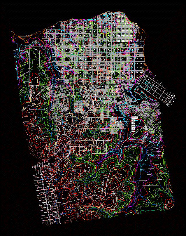
2D urban plan of Posadas, Argentina, providing a detailed topography and altimetry overlay. It features colored contour lines at regular intervals, mapping the terrain across a structured urban grid. The drawing includes numbered residential blocks (chacras) and specific housing development phases (Etapa 1 through 6).
The layout details public amenities such as schools, squares, parking zones, and recreation areas. Technical infrastructure is present, including water supply pipe networks with diameters ranging from 110mm to 600mm, hydrants, cleaning chambers, and a sewage station. Natural features include the Zaimán stream, open-air canals, and dedicated park areas. Curvas de nivel y loteo urbano.