
Subdivision Project DWG Full Project for AutoCAD
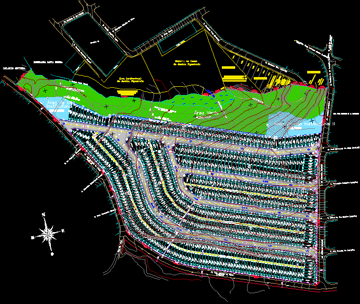
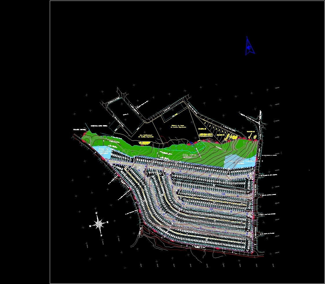
Subdivision project – Map
Drawing labels, details, and other text information extracted from the CAD file (Translated from Portuguese):
permanent protection area, sewage open sky, gs tube, alley, institutional, area of institutional use ii, green area, grotto, source, urban sanitary equipment area:, area of use, Street, alley, a.p.p. permanent protection area, limit of the band non aedificandi, federal law, app area, permanent protection, non-aedificandi track, institutional area, Handel Josà © Pereira, Paulo Pereiro, block, alley, grotto, block, protection range, non, lot, svio belt, lot, leisure system, from the garden figueiredo, lot, Paulo Pereiro, theodoric martins de, jose benedito de lima, paulo alvarino dos santos, estate agency ramos de freitas, sociedad civil de inmuebles ltda., or barbaric sinus, Oliveira, birth, from melo, av. pink teixeira good, cptm station, gianetti, r. José de Moraes, good, r. euclides b. of oak, av. imperial, and is. pref. helmuth h. H. baxmann, r. José Clemente da Silva, av. imperial, r. Fernando Lamb, r. ailton c. of the saints, r. fco pereira de carvalho, av. imperial, av. luiz antonio de paiva, r. new Horizon, r. Juscelino Kubstchek, r. p. benedito machado, av. luiz antonio de paiva, r. diomero vitor, r. deacon francisco pedral, block, r. Ricardo. of araujo, r. georgina ribeiro da silva, r. marcia angelica lopes, r. kiwa iwata, alley, r. diomero vitor, orlando settera, estate agency santa tereza, guassu grass stream, dirt road, limit of the band non aedificandi, federal law, app area, permanent protection, area chart, lots Total number of lots:, discrimination, road system, public areas, farm total, total lot, tour, total population expected for residential lots, number of residential lots, density of residential occupation planned for, at the total area of the farm in ha, coefficient of proportionality, residential development, subtitle, population by residential lot, public areas in ha, urban requirements, cross street cut, perimeter of the ground, subtitle, low point, Hight point, of rainwater, flow direction, registration points, urban institutional areas, urban equipment, community equipment, open spaces for public use area, public area framework, public areas, specification, road system, institutional areas, farm total, total of public areas, urban institutional areas, public use free spaces, tour, for the approval of the subdivision will be presented final project contemplating maximum slope of the lower lots depending on the size of the will be executed in the water distribution network collecting sewage serving all lots., grades, staking in meters
Raw text data extracted from CAD file:
| Language | Portuguese |
| Drawing Type | Full Project |
| Category | Misc Plans & Projects |
| Additional Screenshots |
 |
| File Type | dwg |
| Materials | |
| Measurement Units | |
| Footprint Area | |
| Building Features | Deck / Patio, Garden / Park |
| Tags | assorted, autocad, DWG, full, map, Project, subdivision |