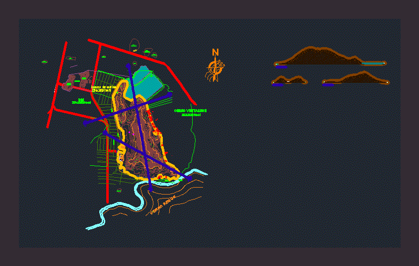
This file contains the blueprint for everything that comprises the archaeological site of Ventarron – Chiclayo with their contours and cuts the Cerro Ventarron .
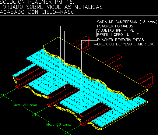
Drawing labels, details, and other text information extracted from the CAD file (Translated from Spanish):
construction site, vertice, side, dist., angle, east, north, ab, tank, third party land, field, sports, baths, hill reque, site, archaeological, architecture, tambo inca, armando, fields, huaca, zarpan , collud, cerro ventarron, hdgdhadg, a pomalca – chiclayo carretera_asfaltada a saltur – sipan, a pomalca – chiclayo carretera_asfaltada, arable land, total