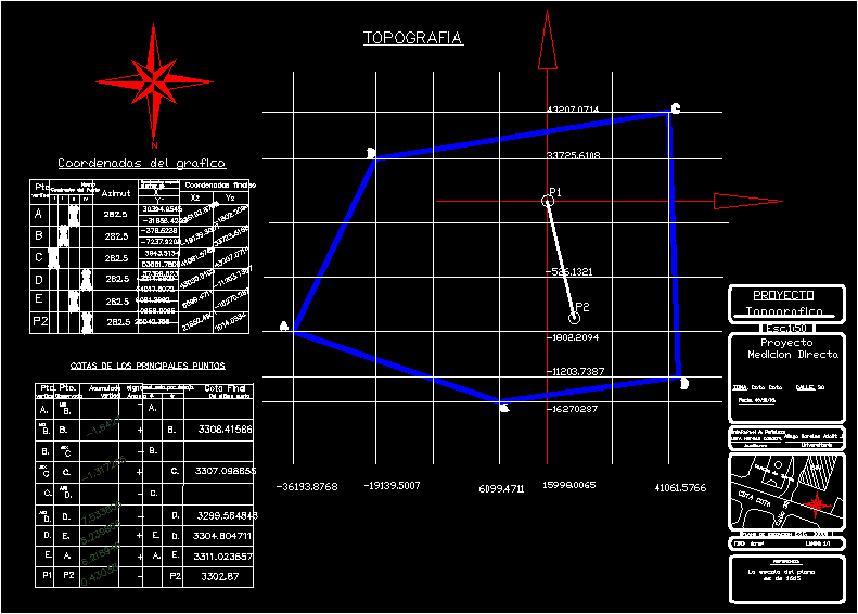
Plane that shows an aerial survey by the method direct mensuration
Drawing labels, details, and other text information extracted from the CAD file (Translated from Spanish):
spreadsheet direct measurement, pos, dist. inclined, pt. obs., pt. est., partial, prom, cumulative, polygonization form, horizontal distance, vertical distance, vertical angle, pto. est., inclined distance, iii, angle of the triangle, spreadsheet calculation of the dimensions, final level, vertical accumulation, vertical angle, level with respect to the ground, project, topographic, project, direct measurement, univ.rafael a. peñaloza, univ. hernan condori., auxiliaries, aliaga morals adalit j., university, location map, reference, normal, ihh, level coordinate, ground field, the scale of the plane, new quadrant of the point, final coordinates, coordinates with respect to the first axis, graph coordinates, final level of the last point