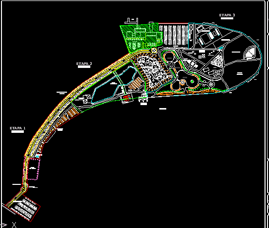
Master plan of the La Playita Urban Recreational Park located along the Rio Bravo. This 2D site layout details a comprehensive development organized into three distinct phases, featuring a mix of active recreation, water access, and public amenities.
The plan includes specialized zones for extreme sports such as a skate park, climbing wall, and bike trails. A dedicated marina area provides docks for catamarans and other river craft. Central public spaces feature an auditorium, sports fields, playgrounds, and a swimming pool complex with wading pools. Support infrastructure shown includes multiple parking lots, a restaurant, camping grounds, a paintball field, and areas for palapas and grills.
Technical documentation within the file provides topographic contour lines with spot elevations, boundary area calculations for each phase, and a site location map. The drawing is a reference for large-scale landscape architecture and regional park planning. Parque Urbano Recreativo La Playita.