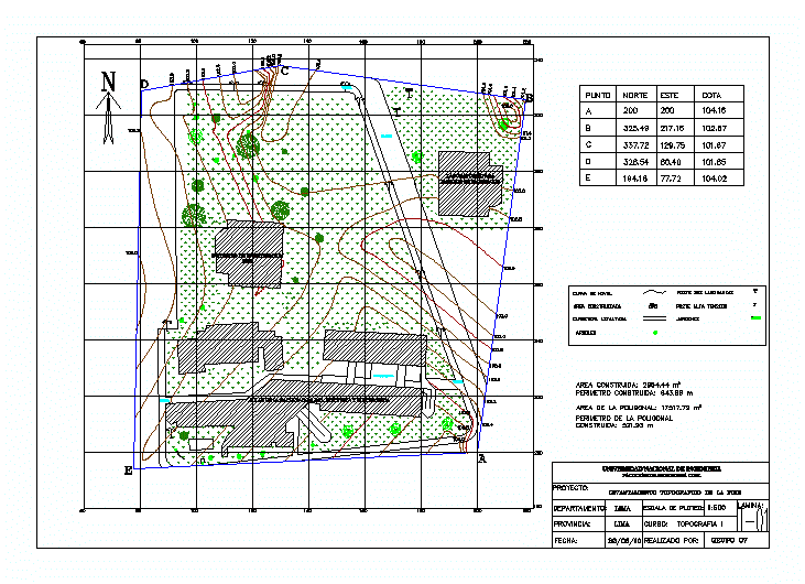
The topographic survey is shown using theodolite; describing elements as mailboxes; poles; green areas .
Drawing labels, details, and other text information extracted from the CAD file (Translated from Spanish):
project :, department :, province :, date :, scale of plotting :, course: topography i, made by :, file, sheet :, topographic survey of the fiee, legend :, specifications :, npt, wooden floor, central patio , polished concrete floor, national university of engineering, district :, photo scale :, rimac, geofoto sa, photogrammetric survey, index curve, intermediate level curve, photogrammetric elevation, road, road, asphalt road, bridle path, irrigation channel , high voltage post, gardens, trees, built area, pole one luminaire, pole two luminaires, research institute fiee, laboratory for material testing, road, point, north, east, elevation, level curve