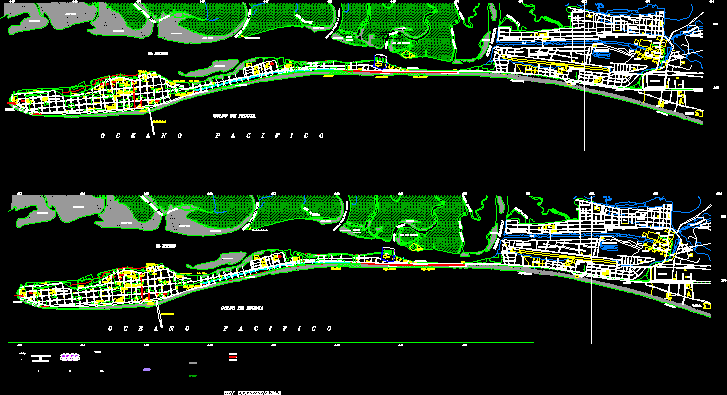
Land Use Costa Rica DWG Block for AutoCAD
LANDS USE . Costa Rica
Drawing labels, details, and other text information extracted from the CAD file (Translated from Spanish):
flora, esquivel, center line of navigation channel, garcia, richard, johnson, stone, current property line, lc, public street, zdce, real folio, pochote, square, avenida alberto echandi montero, beach pochote, beach narrow, property line, public street old road arreo, beach, chacarita, cocal, improvement halfway street, pirate estuary, angostura, island los muertos, estero laps, sand and mud, entrance, estuary, mangrove, winery, water , plaza, pipe, well, power plant, fertile, swimming pools, road the home, home, basketball court, pool, softball court, ammonia, park, orchard, montserrat, san isidro beach, costa rica railway, basketball court , lindavista, estuary, lagoon, monseñor hospital, red, courts, fire, gasoline, honey, terminal, buses, court, volleyball, basketball, center, tanks, ina, regional, justice, pani., bcr, san isidro, carrizal, victor m. sanabria, nitric, government, cross, chacarita, kings, high school, market, cambodia, chacarita, chacarita airport, fray casiano, north chacarita, beach chacarita, santa eduvigis, canal, new town, cemetery, the tip, sand and mud, el carmen, spa, central avenue, calle francisco de paula amador, avenue centenario, tourists walk, malecon, avenida dr. sergio fallas badilla, central street, street pbro. florencio del castillo, paseo leon cortes, pier i greek, estuary, pier pta amarillo, pier de los, bananas, stadium las, playitas, national pier, gym, cocal, cocal beach, est., blind, abandoned cemetery, island los , chanchos, gulf of nicoya, oceanopacifico, estero puerto alto, new town, church, school, palace, municipal, cathedral, library, josé martí, park, the canyons, beach angostura, pochote beach, costa rica railway, isla los dead, laps, plums, estuary pacifier, puntarenas, marine park, urban planning direction, regulatory plan, puntarenas, project:, dedication :, urban planning director:, content:, scale:, source:, arq. Francisco Mora proti, plate:, city puntarenas ,, zoning, date:, Costa Rica, urban computing center, arq. ana maría garcia., tec. Martin Mendez a., tec. sergio barrantes f., project manager:, architect msc. miguel wong s., simbologia, e s c a l a g r a f a c a, tec. leonel zúñiga b., orte, residential area, zrcm, zcrm, zap, zvr, zpi, zst, zim, zeuf, commercial area, mixed commercial residential area, mixed residential commercial area, maritime industrial zone, tourist services area, parks areas , green and recreational areas, controlled development area, future urban expansion area, puntarenas estuary, boulevard and squares, industrial zone, public – institutional zone, protected wild area, invu :, collaborators :, sr. eduardo arguedas g., licda. nelly jimenez r., sr. victor matarrita g., ing. armando rodriguez g., regulatory plan commission:, urban development director, ing. Mauricio Gutierrez v., sr. miguel monge m., coordinator, limit of growth according to minae, to the memory of the, architect zuleyka salom rodriguez, q.d.d.g., zbp, asp, mail, ice, lighthouse, ins, municipality, ccu, without coordinates
Raw text data extracted from CAD file:
| Language | Spanish |
| Drawing Type | Block |
| Category | Patterns, Textures & Backgrounds |
| Additional Screenshots |
 |
| File Type | dwg |
| Materials | Other |
| Measurement Units | Metric |
| Footprint Area | |
| Building Features | Garden / Park, Pool |
| Tags | autocad, block, costa, DWG, land, lands, landschaft, mapa, rica, sky |
