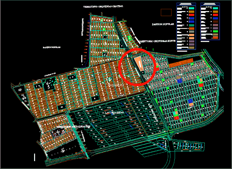
Map of Orchids – Guayaquil
Drawing labels, details, and other text information extracted from the CAD file (Translated from Spanish):
pa, pk, pot, via road, new street axis, public street, acm, green area, polygonal, boundary line, curb line, project channel, nursery, garden, infants, school, school, center, communal, neighborhood, detention, subcenter, medical, child, pumping aa.ss, factory line, park, acv, ps, pr, pq, transformers, pumps, dc, esq, recreational park, agencies, worship, sports, areas, civil defense, ctg, eee, interagua, pacifictel, popular bastion, implementation of areas, kindergarten, community services, commercial area, administration and services, medical center, community center neighborhood, medical subcenter, social assistance, market, green areas , sports, orchids, more food, fire stations, post, commissars, municipal, civil registry, orchids, parterre, sports communal area, community center, avenue francisco de orellana, the geraneos ii, central orchid territory, northern orchid territory , territory orchids r, garden, pedestrian, vehicular