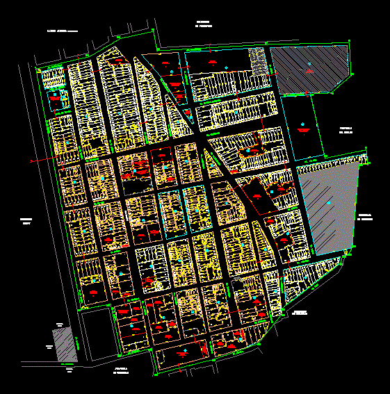
Map Location Salverry DWG Block for AutoCAD
MAP LOCATION SALVERRY – ENAPU URBAN DISTRICT SALAVERRY; RECOGNIZED BY COFOPRI
Drawing labels, details, and other text information extracted from the CAD file (Translated from Spanish):
Sections of roads, ca. Piura, property, ca. pacasmayo, ca. lambayeque, ca. sucre, ca. gamarra, ca. freedom, ca. Cordova, ca. the brand. the rivera, ca. the marina, ca. Customs, ca. trujillo, ca. chiclayo, ca. orbegoso, av. petroperu, prolg. freedom, malecon velarde, ca. the rivera, ca. monitor huascar, prolg. chiclayo, prolg. trujillo, enapu, av. the navy, psje. the marina, passage b, ca. the sea, of third parties, of the state, of petroperu, p.i.luis alberto sanchez, psje. morante, ca. viru, suspended lot, cut b – b, lp, cut a – a, cut f – f, cut c – c, cut g – g, cut d – d, cut e – e, general table of distribution of areas, use , useful area, commercial area, urban equipment area, public recreation, parks, sports area, complementary public services, education, health services, excluded area, other purposes, area of circulation, total area, project, plane: location :, indicated, lamina: fire station sub, location map, location map, location and location, date :, scale :, district of salaverry – trujillo, district of salverry – trujillo
Raw text data extracted from CAD file:
| Language | Spanish |
| Drawing Type | Block |
| Category | Handbooks & Manuals |
| Additional Screenshots |
 |
| File Type | dwg |
| Materials | Other |
| Measurement Units | Metric |
| Footprint Area | |
| Building Features | Garden / Park |
| Tags | autocad, block, cofopri, district, DWG, location, map, urban |
