Perimeter Plan DWG Plan for AutoCAD
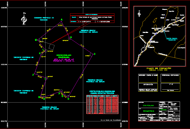
PERIMETER PLAN OF TOWN CENTER OF Chaucalana in Tacna – Peru. CONTAIN BOARD OF TECHNICAL DATES
Drawing labels, details, and other text information extracted from the CAD file (Translated from Spanish):
locumba, jorge basadre, tacna, delia yolanda, mamani uhanca, technical:, department:, prepared by:, topography:, property code :, province:, district:, ubigeo:, legal:, projection system: utm, archive , scale, date, ——, plan approved by jefatural resolution, plan :, enrique melgar moscoso, approval, supervision and quality control, responsible professional, technical area, head of the zonal office tacna, joel cruz, ventura , j.rios, populated center:, chaucalana, perimetric, cd, deep ravine, road to ilabaya, pond, water, locumba district, bahamontes creek, river, salty, hill chaucalana, canalprincipal, main channel, blowing, riolocumba, river locumba, bocatoma, of ite, meter, main channel of ite, hill bargains, river, river locumba, zl, reservoir, chirontita, chironta, matogroso, pampa cinto, oconchay, huaracane, margarita, the trunks, neighborhood, cuylata, chaucalana , pinapa, pampa sitana, camiar a, glory milk plant, the aurora, south camiara, lomas arrojadero, populated center, traditional village, south pan-American, location map, scree pediment, reference point, southwest vertex of the existing community center of the town, coordinates, location, vertice, side, distance, ang. internal, ab, bc, cd, of, ef, fg, gh, hi, ij, jk, kl, lm, ma, total, table of technical data, village center, land owned by third parties, uncultivated land, property of the state
Raw text data extracted from CAD file:
| Language | Spanish |
| Drawing Type | Plan |
| Category | Handbooks & Manuals |
| Additional Screenshots |
 |
| File Type | dwg |
| Materials | Other |
| Measurement Units | Metric |
| Footprint Area | |
| Building Features | |
| Tags | autocad, board, center, DWG, perimeter, perimetric, PERU, plan, Tacna, technical, town |
