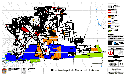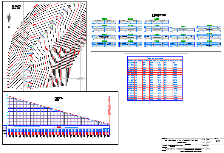
PlanContours – Profiles – volume table
Drawing labels, details, and other text information extracted from the CAD file (Translated from Spanish):
sections, ng, slope, subgrade, terrain, mileage, volume table, station, fill area, cut area, vol fill, vol cut, acum vol rell, acum vol cut, dist.:, prov.:, drawing :, dept ., date :, scale :, plant profile and sections, address of urban development and public works, owner :, project :, description:, professional :, candarave, cairani, sheet :, tacna, indicated, jlqp, district municipality, responsible :, ing. diego armando quispe ortega, plant, profile