Urban Regional Network Puno DWG Plan for AutoCAD
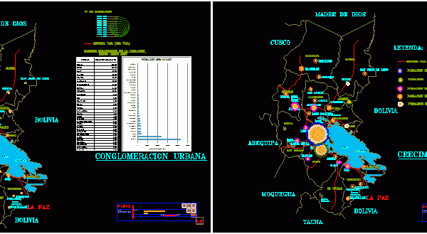
THIS WORK CONTAINS THE ROUTE OF THE REGION WITH ALL PROVINCES PUNO, EACH CONTAINING THE PLANS FIRST FIRST TOP 30 MOST POPULATED CITIES WITH POPULATION respective owner PICTURES OF INFLUENCE…
![]()

THIS WORK CONTAINS THE ROUTE OF THE REGION WITH ALL PROVINCES PUNO, EACH CONTAINING THE PLANS FIRST FIRST TOP 30 MOST POPULATED CITIES WITH POPULATION respective owner PICTURES OF INFLUENCE…
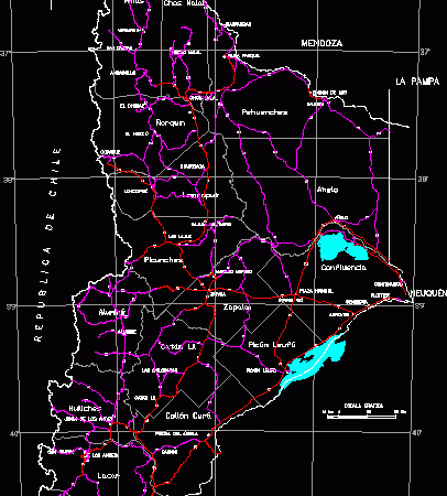
MAP BSE OF NEUQUEN. IN TRUE SCALE WITH PROVINCES AND PROCESSED PAVED ACCESS AND NOT PAVED;WORKED IN gauss grubber; WITH GOEGRAPHIC COORDINATES BUT IN SCALE FOR PLACING UTM;GRAPHIC SCALE;MAGNETIC NORTH….
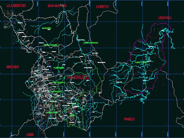
provinces, districts, Hydrography, Roads Drawing labels, details, and other text information extracted from the CAD file (Translated from Spanish): both, May 2nd, Huacaybamba, huamalies, leoncio meadow, cashew, Inca port, laurel,…
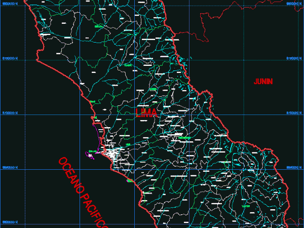
LIMA provinces and districts; HYDROLOGY Drawing labels, details, and other text information extracted from the CAD file (Translated from Spanish): callao, beautiful view, carmen de la regua reynoso, the Pearl,…

HUANCAVELICA HYDROGRAPHY PROVINCES AND DISTRICTS – georeferenced Drawing labels, details, and other text information extracted from the CAD file (Translated from Spanish): huancavelica, acobambilla, acoria, concave, basin, huachocolpa, huayllahuara, izcuchaca,…