
Road And Tourist Map – Map Of The Region Of Junin DWG Detail for AutoCAD
The map of the region of Junin is in detail and with a picture of festivities according to the dates also can see the towns districts and provinces with their…
![]()

The map of the region of Junin is in detail and with a picture of festivities according to the dates also can see the towns districts and provinces with their…

Map of Region de los Rios Valdivia Chile Drawing labels, details, and other text information extracted from the CAD file (Translated from Spanish): estero pichicollico, route, pje cudico, terminal, from…
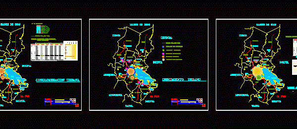
Conglomerate Urban region of Puno in Peru is shown with its thirteen provinces, its population, its population growth, where the major companies in the region are concentrated Drawing labels, details,…
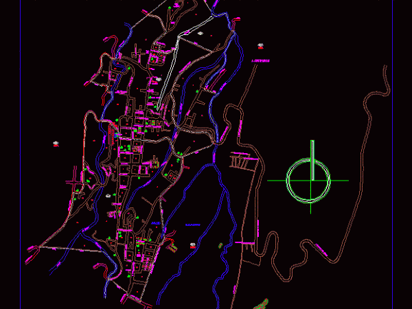
Tlatlauquitepec Township; Puebla is located in the Sierra Norte de Puebla; part of the Region Teziutlán and has its headwaters in the City Tlatlauquitepec. It has a population of nearly…
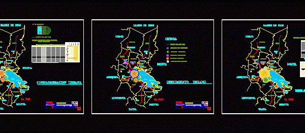
Perimetrico with coordinates Plano – population – road system -. Etc. Drawing labels, details, and other text information extracted from the CAD file (Translated from Spanish): province, total of companies,…