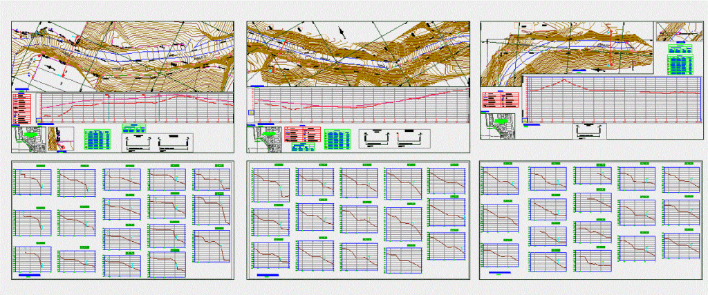
Topography Rural Village Center – Building Plan – Longitudinal Profile
Drawing labels, details, and other text information extracted from the CAD file (Translated from Spanish):
l.p.e, l.p.c, station, stake, esq, lpc, buzoneta, access, foot, see, esc, entry, shoulder, pirca, est, cex, broken, park, mz.poste, psje. mounts, property of third parties, salable urban equipment, medical, axis profile, progressive, elevation, terrain, existing limit, lot cofopri, pirca, cofopri, l.pc, property limit, section according to, ce, existing, survey, axis, wall axis, construction, rural town center, human settlement, manchay orchards, sector b, construction, provisional, house entrance, bms table, north, east, description, elevation, pee box, prog., distance, location :, floor plan, start of wall, longitudinal profile, legend, cross sections, end of wall, drain mailbox, existing road, auxiliary bm, contour lines, existing limit, magnetic north, light pole, existing pirca, pee , water register, light meter, entrance to house, ing :, entry level to house, limit cofopri