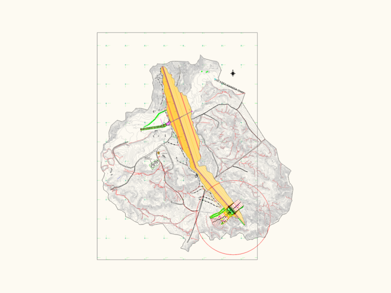
Detailed intervention plan for improving water resources in the AMPI-Arequipa Fundo project located in Chivay district, Caylloma province, Arequipa department, Peru. The drawing shows three key water management components with precise geodetic coordinates in WGS-84 datum (UTM Zone 19S):
Project Components:
1. Micropresa (Micro-dam): Area of 11,755.5 m² (1.18 ha) with perimeter of 2,201.93 ml
2. Afloramiento 03 (Water Spring 03): Area of 11,900.95 m² (1.19 ha) with perimeter of 2,105.38 ml
3. Afloramiento 04 (Water Spring 04): Area of 2,235 m² (0.2235 ha) with perimeter of 316.63 ml
The plan includes comprehensive technical data tables for each component featuring vertices, sides, distances, internal angles, and UTM coordinates. The drawing incorporates regional and district location maps showing the project’s position within Caylloma province and neighboring districts, providing critical geographical context for the water improvement infrastructure.