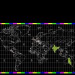
Hour Areas DWG Block for AutoCAD
World map with hour areas
Drawing labels, details, and other text information extracted from the CAD file:
ecuador, colombia, venezuela, guyana, suriname, guiana, french, brazil, uruguay, paragury, bolivia, peru, chile, argentina, part, date, rev, ch’k, app’d, cedar rapids, ia, its use, reproduction or dissemination, communications corp. is strictly prohibited., without the express permission of mci, the property of mci communications corp., this information is confidential and remains, date: file: sheet:, document title:, drawn by:, scale, size, kenneth ketelsen, none, global systems, faith and believed to be accurate, mci and isn, global systems do not guarantee satisfactory, while this information is presented in good, results from reliance upon such information., sun, sat, ecuador, colombia, venezuela, guyana, suriname, guiana, french, brazil, uruguay, paragury, bolivia, peru, chile, argentina, mexico, united states, canada, u.s., greenland, iceland, guatemala, honduras, nigaragua, costa rica, panama, cuba, belize, el salvador, france, spain, portugal, algeria, tunisia, italy, switzerland, austria, germany, belgium, netherlands, poland, slovakia, hungary, croatia, serbia, bosnia, albania, f.y.r.o.m., bulgaria, romania, greece, slovenia, republic, czech, ireland, kingdom, united, denmark, norway, sweden, finland, turkey, morocco, western, mauritania, senegal, the gambia, guinea bissau, guinea, sierra leone, liberia, ivory, ghana, bemin, burkina, mali, nigeria, cameroon, garbon, congo, zaire, angola, namibia, south africa, botswana, zimbabwe, mozambique, zambia, malawi, tanzania, uganda, kenya, somalia, ethiopia, sudan, chad, libya, saudi arabia, yemen, oman, madagascar, sahara, niger, coast, togo, c.a.r., eritren, djibouti, lebanon, israel, jordan, syria, iraq, iran, afghanistan, pakistan, india, nepal, bhutan, bangladesh, burma, thailand, laos, vietnam, cambodia, malaysia, indonesia, philippines, new guinea, australia, new zealand, solomon islands, china, mongolia, n. korea, s. korea, japan, russia, north, atlantic, ocean, south, indian, pacific, arctic, berlin, paris, brussels, tokyo, mexico city, amsterdam, madrid, london, scotland, buenos aires, santiago, bogota, copenhagen, vienna, tel aviv, luxembourg, lux, lisbon, praque, athens, budapest, warsaw, leipzig, toronto, rome, oslo, stockholm, helsinki, singapore, kuala lumpur, seoul, taiwan, tapei, mumbai, new delhi, adelaide, jakarta, auckland, lima, moscow, johannesburg, guatemala city, bangkok, beijing
Raw text data extracted from CAD file:
| Language | English |
| Drawing Type | Block |
| Category | Handbooks & Manuals |
| Additional Screenshots |
 |
| File Type | dwg |
| Materials | Other |
| Measurement Units | Metric |
| Footprint Area | |
| Building Features | |
| Tags | areas, autocad, block, DWG, map, world |
