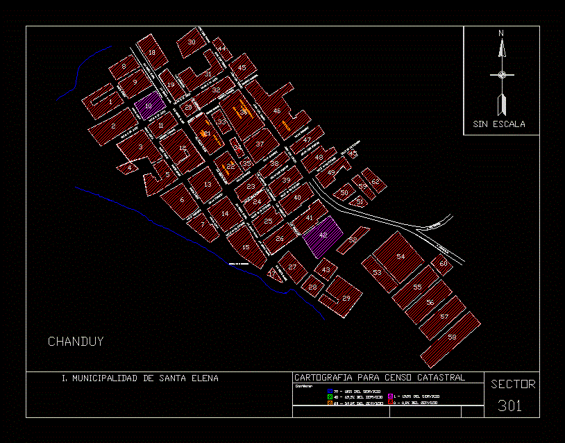
Chanduy Cartography; St Helen; Ecuador DWG Block for AutoCAD
Mapping My Municipality of Sta. Elena for cadastral survey
Drawing labels, details, and other text information extracted from the CAD file (Translated from Spanish):
cdp scanning equipment, cartography for cadastral census, supervised by: msig. geovanna garcia, date, contains:, digitized by:, from service, January, cdp scanning equipment, i. municipality of santa elena, urban cadastral census, cartography for cadastral census, supervised by: msig. geovanna garcia, date, contains:, Polytechnic School of the coast, digitized by:, from service, January, unscaled, telephone service per apple, walkway by block, potable water service per block, sanitary sewer service per block, storm sewer service per block, electric power service per block, sector, av. st. Helen, Coliseum, rural police, society, worker, sports area, market, ietel, community House, av. st. Helen, June street, ramon munoz, jose luis tamayo, San Rafael, tagged, av. st. Helen, supply center, the vergeles, June street, cesario career, June street, cesario career, street trade, street luis rosales, October street, av. st. Helen, ramon munoz, cesario career, the vergeles, av. st. Helen, October street, note: the mz. does not exist, chanduy
Raw text data extracted from CAD file:
| Language | Spanish |
| Drawing Type | Block |
| Category | City Plans |
| Additional Screenshots |
 |
| File Type | dwg |
| Materials | |
| Measurement Units | |
| Footprint Area | |
| Building Features | Car Parking Lot |
| Tags | autocad, beabsicht, block, borough level, cadastral, cartography, DWG, ecuador, mapping, municipality, political map, politische landkarte, proposed urban, road design, st, stadtplanung, straßenplanung, survey, urban design, urban plan, zoning |
