ADVERTISEMENT

ADVERTISEMENT
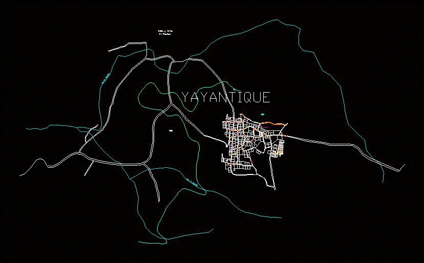
Map Yayantique; The Union DWG Block for AutoCAD
MAP OF THE MUNICIPALITY OF Yayantique; DEPARTMENT OF THE UNION; THE SAVIOR
Drawing labels, details, and other text information extracted from the CAD file (Translated from Spanish):
qda. the rumor, I lable the cane, yayantique, baby cunt, The Shepherd, hundred, av el clavelino, cton el tejar, Panamerican’s highway, cton rye, avenue san jacinto, west street, av.san juan norte, street east, avenue san juan norte, avenue san jacinto, north avenue, san juan south avenue, south avenue, street east, avenue, clavelino, south avenue, avenue garcia nagera, san juan south avenue, san antonio street, velasquez ticket, san juan south avenue, south avenue, north avenue, calle el calvario, south avenue, avenue, garcia nogera
Raw text data extracted from CAD file:
| Language | Spanish |
| Drawing Type | Block |
| Category | City Plans |
| Additional Screenshots |
 |
| File Type | dwg |
| Materials | |
| Measurement Units | |
| Footprint Area | |
| Building Features | Car Parking Lot |
| Tags | autocad, beabsicht, block, borough level, department, DWG, El Salvador, land, map, municipality, political map, politische landkarte, proposed urban, road design, savior, stadtplanung, straßenplanung, union, urban design, urban map, urban plan, urbanism, zoning |
ADVERTISEMENT
