ADVERTISEMENT

ADVERTISEMENT
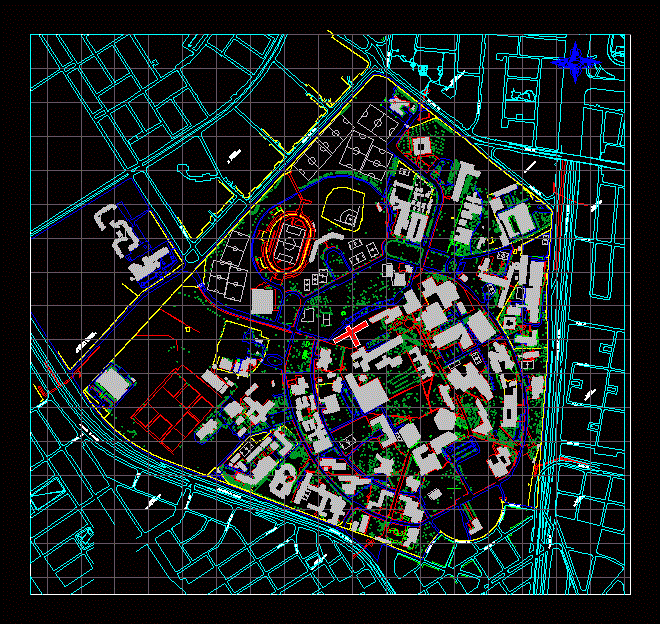
Location Map National University DWG Block for AutoCAD
Locator Map of the National University of Colombia; It includes all buildings and surrounding neighborhoods to college.
Drawing labels, details, and other text information extracted from the CAD file (Translated from Spanish):
avenue city of quito, freeway el dorado, diagonal, cross, Street, neighborhood, belalcazar, neighborhood, loneliness, neighborhood, belalcazar, neighborhood, nicolas de federman, neighborhood, the Emerald, neighborhood, fifth walls, colsubsidio, avenue, avenue city of quito, freeway, The Golden, freeway, The Golden, Street, diagonal, career, diagonal, career, Street, diagonal, career, neighborhood, fifth walls, career, Street, race bis, career, National Institute, radio television
Raw text data extracted from CAD file:
| Language | Spanish |
| Drawing Type | Block |
| Category | City Plans |
| Additional Screenshots |
 |
| File Type | dwg |
| Materials | |
| Measurement Units | |
| Footprint Area | |
| Building Features | Car Parking Lot |
| Tags | autocad, beabsicht, block, borough level, buildings, College, colombia, DWG, includes, location, map, national, neighborhoods, political map, politische landkarte, proposed urban, road design, stadtplanung, straßenplanung, surrounding, university, urban design, urban plan, zoning |
ADVERTISEMENT
