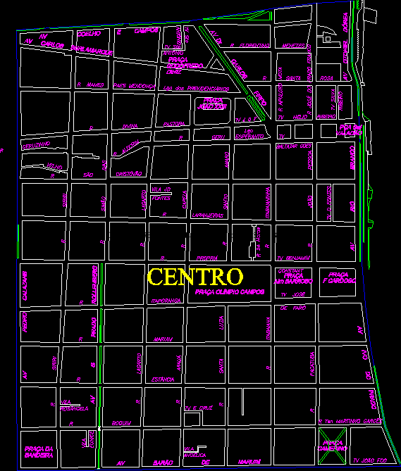
Map Central District, Aracaju, Brasil DWG Block for AutoCAD
Neighborhood Center, Aracaju, Sergipe, Brazil.
Drawing labels, details, and other text information extracted from the CAD file (Translated from Portuguese):
Av. Barão de Maruim, tv joão fco, own, orange trees, Saint Cristopher, geru, Rosemary, divine shepherd, valadion, mamed paes mendonça, av carlos burlamarque, Saint pink, florentine menezes, av rabbit fields, av pedro calazans, Siriri, simão dias, lizard, antônio, chapel, holy amaro, it was cool, av dr carlos firpo, av otoniel dórea, joão pessoa, av rio branco, sources, tv sto, villa jd, tv hélio ribeiro, tv sources, little germinate, gal par, maruim, office, Siriri, village, it is good, tv cross, pacatuba, ten martinho garcêz, mouthpiece, village, angelica, square, cardoso, square, alm muddy, square olympic fields, flag, square of, dressing room, square, village, rosangela, Santa Luzia, arauá, lizard, Eunice, av prado rollemberg, old, Itabaian, tv josé, of lighthouse, tv benjamin, constant, hours, avocado meadow, lgo, Esperanto, baltazar goes, square, joao xxiii, square, godfrey, diniz, of social security, apulcro butte, Josà © of the free meadow, tv silva, brook, antônio, tv sto, center
Raw text data extracted from CAD file:
| Language | Portuguese |
| Drawing Type | Block |
| Category | City Plans |
| Additional Screenshots |
 |
| File Type | dwg |
| Materials | |
| Measurement Units | |
| Footprint Area | |
| Building Features | Car Parking Lot |
| Tags | aracaju, autocad, beabsicht, block, borough level, brazil, center, central, district, DWG, map, neighborhood, political map, politische landkarte, proposed urban, road design, sergipe, stadtplanung, straßenplanung, urban design, urban plan, zoning |
