ADVERTISEMENT

ADVERTISEMENT
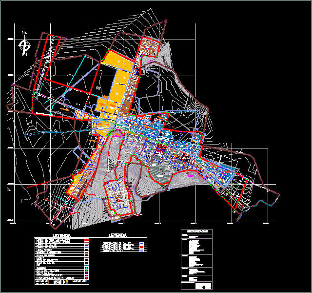
Cadastre Anta DWG Block for AutoCAD
Cusco department location – province Anta – Anta disrtrito. This plane contains consolidated area boundaries limit urban expansion, industry limit, limit of neighborhoods, roads and highways, rivers landmark geo referenced.
Drawing labels, details, and other text information extracted from the CAD file (Translated from Spanish):
urb. Santa Rita
Raw text data extracted from CAD file:
| Language | Spanish |
| Drawing Type | Block |
| Category | City Plans |
| Additional Screenshots |
 |
| File Type | dwg |
| Materials | |
| Measurement Units | |
| Footprint Area | |
| Building Features | Car Parking Lot |
| Tags | area, autocad, beabsicht, block, borough level, cadastre, cusco, department, DWG, highways, location, plane, political map, politische landkarte, proposed urban, province, rivers, road design, roads, stadtplanung, straßenplanung, urban design, urban plan, zoning |
ADVERTISEMENT
