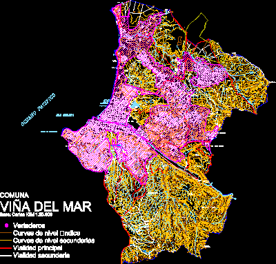
Plane Commun ViÑA Del Mar DWG Elevation for AutoCAD
Plane commun Viña del Mar – Urban elevation
Drawing labels, details, and other text information extracted from the CAD file (Translated from Spanish):
German villa, Base: igm cards, Secondary road, Main road, Secondary level curves, Index level curves, Dumps, commune, co. hope, the ashes, High stone, The quillayes, The seven sisters, co. The goldfinch, Reservoir boy, Estero, Viña del Mar, lagoon, Sausalito, reservoir, Granadillo, Loma the quillayes, the Palm trees, Port aisen, South chile, San Miguel, Beagle channel, Expensive cardinal, Lomas chorrillos, Chorrillos, the effort, South forest, The seven sisters, Vina del mar alto, Brown hair, Miramar, Empart, Holiday rentals Vergara, forest, grandchild, Chorrillos, Sweet villa, Crav, North sweet villa, Miraflores alto, Sporting club, Plaza mexico, casino, stadium, Sausalito, Holy Ines, cemetery, Holy Ines, freedom, Achupallas, Santa julia, White beach, Sun beach, Acapulco beach, dock, Vergara population, Cove, Embrace, Viña del Mar, Pacific Ocean, Chilean sea, Bay of valparaiso, Forest reservoir, Santa julia, The salinas, Montemar, Lagoon, Express vina, naval glories, Gomez carreno, Top of the cross, Pta. Bears, The salinas, Spa, Playa los marinos, long Beach, Renaca beach, Cochoa, Estero, Renaca, Renaca, co. Charcoal, Charcoal, co. Colorado, co. High condor, co. Molle, Molle, Loma latorre, the olive grove, Botanical Garden, Pte. Deep step, High the house, Romazal, High renaca, Santa julia, independence, beautiful villa, Quillayes, The seven sisters, Sea vineyard, ravine, drawer, co. sheet, co. Torquemado, High renaca, Viña del Mar, Base: igm cards, Secondary road, Main road, Secondary level curves, Index level curves, Dumps, commune
Raw text data extracted from CAD file:
| Language | Spanish |
| Drawing Type | Elevation |
| Category | City Plans |
| Additional Screenshots |
 |
| File Type | dwg |
| Materials | |
| Measurement Units | |
| Footprint Area | |
| Building Features | Car Parking Lot, Garden / Park |
| Tags | autocad, beabsicht, borough level, del, DWG, elevation, mar, plane, political map, politische landkarte, proposed urban, road design, stadtplanung, straßenplanung, urban, urban design, urban plan, vi, zoning |
