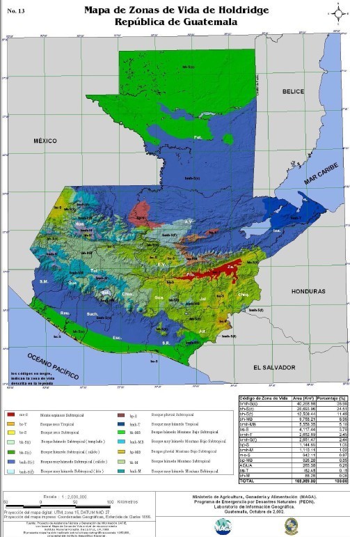
1:2,000,000 scale map of Guatemala depicting bioclimatic regions based on the Holdridge Life Zones system. This 2002 edition by the Ministry of Agriculture (MAGA) classifies the territory into ecological categories such as subtropical dry forest, tropical moist forest, and montane wet forest.
The document includes a legend with zone codes, land area in square kilometers, and percentage coverage for each classification. It is used for regional planning, environmental studies, and agricultural mapping. Mapa de Zonas de Vida de Holdridge República de Guatemala.