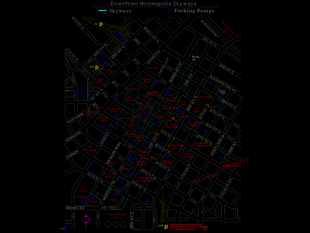
map of the downtown Minneapolis skyway system and major parking ramps. has street names, curbs, landmarks like the convention center & metrodome, and traffic flow arrows. drawn in imperial units (feet) for urban planning or reference. covers the whole downtown core from the river down to the highway.
Downtown Minneapolis Skyway & Parking Ramp Map DWG Plan