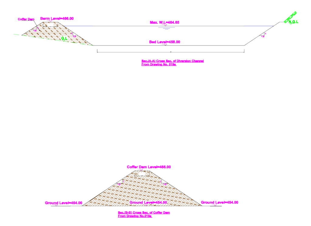
Cross-sections for a diversion channel & a coffer dam, including Natural Ground Level (N.G.L) and Bed Level markers. Section A-A shows the channel with a bed level at 458.00 and a max water level of 464.65. I’ve noted the berm level at 466.00 with 1.5:1 side slopes for the earthwork. Section B-B covers the coffer dam itself, showing a 466.00 crest level against a 454.00 ground level. It’s drawn in metric with clear hatch patterns for fill materials, incl. labels for G.L & N.G.L. These templates work well for hydraulic infrastructure planning or temporary water management projects etc.
Hydraulic Dam Diversion & Coffer Dam Sections