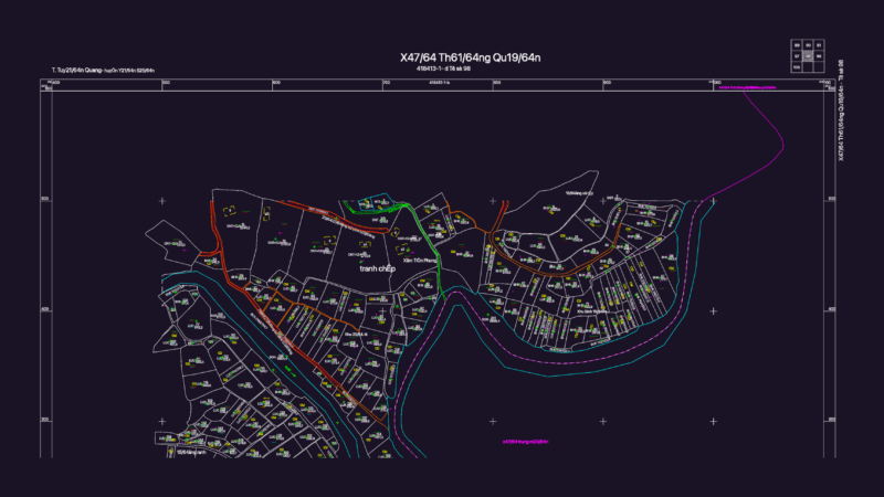
Irrigation system layout for the Fortaleza project located in Pariacoto, Huaraz. Shows detailed topographic contour lines, property boundaries for various beneficiaries, and technical data tables with UTM coordinates (WGS 84, Zona 18 Sur). Includes locations for hydrants, a 4.00 x 4.00 x 1.20 m loading chamber and hydraulic gradient elevations from 2860 to 2895 m. The plan covers areas in hectares and square meters, showing exact distances & angles for each lot. Used for rural water infrastructure development or land survey references. It’s got the full site layout incl. pipe lengths, levels, etc. Planta del sistema de riego Fortaleza en Pariacoto, Huaraz. Incluye curvas de nivel, cuadros de datos técnicos UTM y detalles de hidrantes.
Irrigation System Layout Fortaleza Project Pariacoto Huaraz