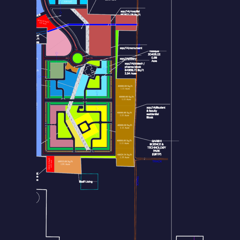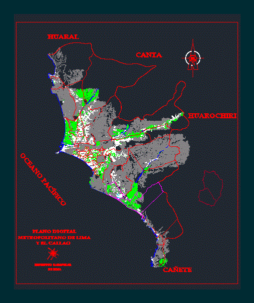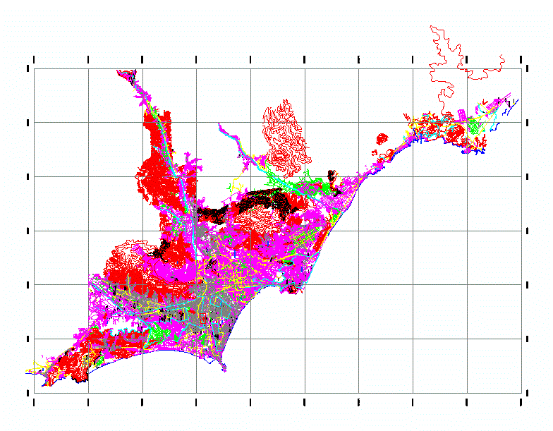
2D AutoCAD plan of the city of Lima, Peru, featuring a large-scale urban layout with street networks, neighborhood boundaries, and topographic data. The drawing covers the central capital area and surrounding districts including Cercado, San Fernando, and Villa Maria del Perpetuo Socorro.
Technical details include a coordinate grid system, arterial road layouts for Av. Abancay and Av. Arequipa, and topographic contour lines showing elevation. Specific landmarks such as Puente de Piedra and major industrial zones are labeled throughout the plan. This file provides technical base data for urban zoning, municipal planning, and site context mapping. Plano general de la ciudad de Lima.