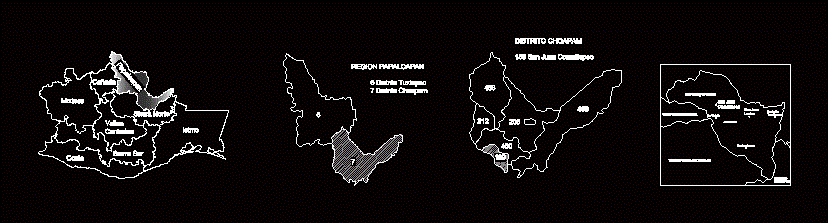
Include Oaxaca state map with the division of the eight regions; Papaloapan region with district division; Choapam divisón Municipal district and finally the municipality of San Juan Comaltepec .
Drawing labels, details, and other text information extracted from the CAD file (Translated from Spanish):
mixteca, glen, papaloapan, central valleys, sierra norte, isthmus, southern sierra, costa, san juan comaltepec, totontepec villa de morelos, santo domingo roayaga, santiago zacatepec, san juan lealao, san isidro tres arroyos, hondura lucero, lachixova, la victoria, san francisco the waterfall