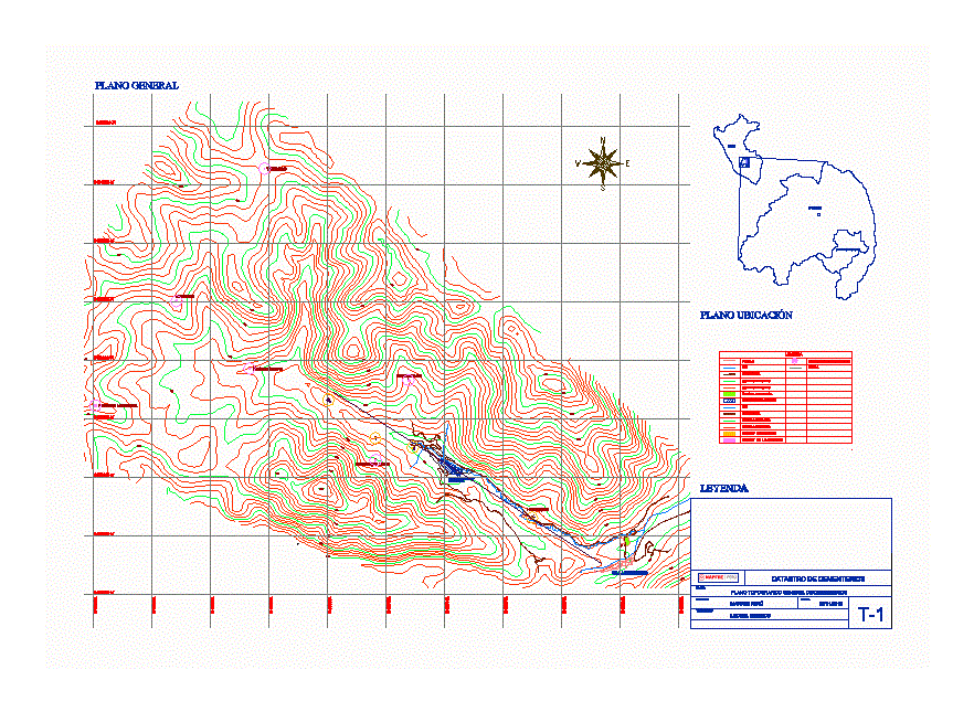
Cemetery Feurebamba community – Cotabambas Apurimac
Drawing labels, details, and other text information extracted from the CAD file (Translated from Spanish):
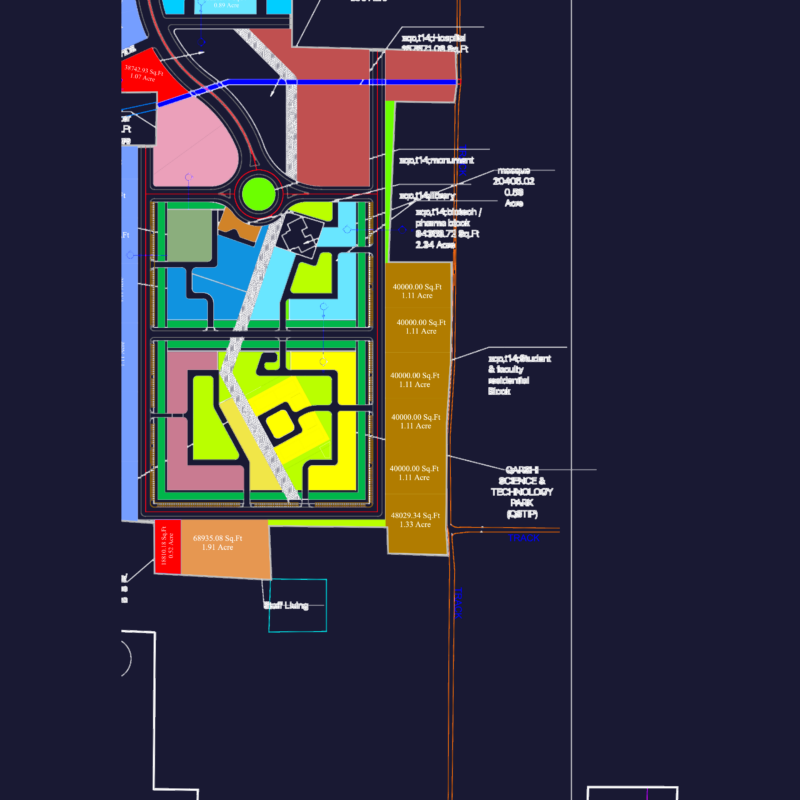
perimeter, perimeters, perimeter., antenor orrego, faculty of architecture, private university, urbanism and arts, whitewashed sector, cesar vallejo with av. fatima, crossing of the prolongation, teachers:, arq. Arming li kuan arq. diana turoni, district of victor larco, location:, private university, cultural center of, architecture, scale :, plane :, specialty :, general plan of the project, student:, carlos c. briceno, date :, sheet :, general plan of distribution, construction table, vertex, side, dist., angle, east, north, ab, cemeteries cadastre, plane:, cemeteries, company: mapfre peru, esc :, observations: some tombs are physically present which are very few so it was decided to return to the land with relatives for the exact recognition of the deceased and their location, raise the perimeter and tombs, most tombs are found physically present with the exception of some empty spaces which we assume that there are no graves but we need to corroborate, it is also necessary to identify who has died in that tomb raised in the plane and with our database, huatayhuasi ccata, ccomerccacca, tomocco, fb center , zeal fence, sachachayoc mocco, machamahuaycco, pukacorral, tomocco, huancarpalla, challhuahuacho, ferrobamba mining camp, apurimac, peru, legend, town, river, road, major curves, soccer, mining camp, minor curves, cement. raised, cement. not raised, location of cemeteries, grid, flat location, general map, general topographical map of cemeteries, topografo :, leonel berrios