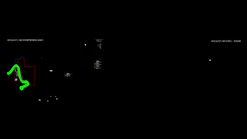
Topographical site plan for a basalt quarry in Erechim, Rio Grande do Sul, Brazil. This drawing displays multiple boundary polygons including mining concession area (ANM 810.365/2009), environmental boundary, extraction boundary, and property limits with UTM coordinates (SIRGAS 2000 datum).
Key Features:
- Detailed topographic contours (ranging from 650-695m elevation)
- Watercourse with 30m APP (permanent preservation area) buffer
- Electrical transmission line easement
- Municipal vicinal road
- Vegetation classification zones (primary, secondary initial, secondary medium)
- Stockpile areas and constructed features
The plan documents January 2022 survey data and references Office 4055-2021 for environmental boundary updates. The georeferenced drawing includes coordinate grid points and cardinal direction indicators with magnetic declination information. Scale is 1:3100, with the site primarily situated between E378,700m-E379,450m and N6,939,350m-N6,940,100m.