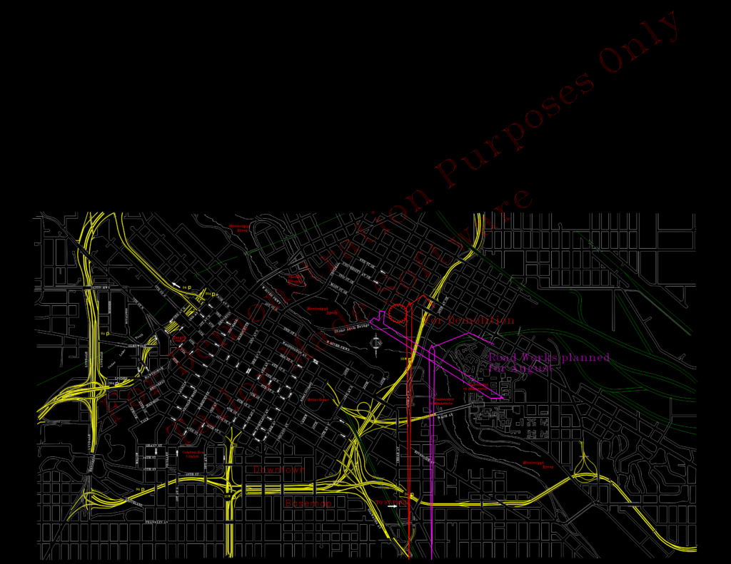
Base map of central Minneapolis, covering the downtown core out to the University of Minnesota area. Includes the street grid, curb lines, freeway interchanges for 35W and I-94, and some rail infra. You’ll find labels for major landmarks—Target Center, Convention Center, the old Metrodome site, etc. There’s some specific redline markup showing planned road works and a demo zone near the Stone Arch Bridge. Units are in feet, drawing is roughly 23,000′ x 12,000′. Scaled to fit an ANSI D sheet layout.
Minneapolis Downtown Base Map with Infrastructure and Planning Markups