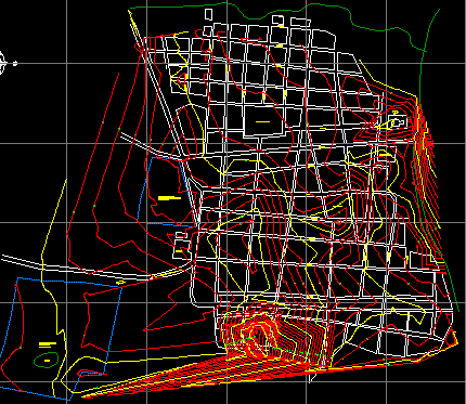
Municipality Plane Cordoba – Bolivar DWG Block for AutoCAD
Plane municipality
Drawing labels, details, and other text information extracted from the CAD file (Translated from Spanish):
left, top, left, top, near by, water well, top, water well, close, top, water well, top, close, top, left, top, top, close, near by, top, left, close, near by, orivia, left, orivia, close, orivia, top, top, close, top, close, top, top, via, close, point, top, via, ori via, I saw about, point, point, point, left, point, left, left, point, point, left, there exist, point, left, point, tank, point, top, tank, tank, top, corner, tank, top, tank, tank, point, point, point, left, point, point, point, point, point, esq tank, point, esq tank, point, limit of, Coliseum, left, point, left, left, left, point, left, top, left, point, top, top, left, top, point, left, point, Coliseum, top, Coliseum, to close, top, top, left, ridge, left, ridge, ridge, point, ridge, point, ridge, orivia, ridge, orivia, barge, ridge, guiding, point, Street, Street, career, zambrano road, old carmen road, future urbanization housing area:, future urbanization relocation of displaced persons:, lagoon, soccer field, sports Center, hospital, cemetery
Raw text data extracted from CAD file:
| Language | Spanish |
| Drawing Type | Block |
| Category | City Plans |
| Additional Screenshots |
 |
| File Type | dwg |
| Materials | |
| Measurement Units | |
| Footprint Area | |
| Building Features | Car Parking Lot |
| Tags | autocad, beabsicht, block, bolivar, borough level, cordoba, DWG, municipality, plane, political map, politische landkarte, proposed urban, road design, stadtplanung, straßenplanung, urban design, urban plan, zoning |
