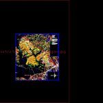
Plano Decchongon DWG Block for AutoCAD
Plane Chongon
Drawing labels, details, and other text information extracted from the CAD file (Translated from Spanish):
symbology, primary road, secondary road, edges of, ports, cabins, units of research, crops, natural drainage, homes, holiday complexes, area restaurants, play areas, Hotels, parking lot games, avenue paquisha, avenue paquisha, main camp, from cedege, farm, cynthia farm, cerro san juan, high, structures, anita farm, club, reservoir, Water, aperitif, transfer gate, stable, corporate headquarters, high, scrub, pool, sun orchards, conveyance farms, scrub, barbed wire, san fernando finca, farm the meadow, the triumph, barbed wire, dam of, saint, san edward farmhouse, scrub, barbed wire, toll booth, channel, escort, escaforce school of, security guards, mat, scrub, esc liberator, despatcher, of exemption, sub, opening tower, of gates, daule transfer channel, wicket, sluice gates, shed, hsan enrique, h carmel, hola glola, henry henry, to come, h.santa martha, the glory, h.san vicente, chongon river, river flint, Cerro cereceras, cerro san juan, graphic scale, symbology, primary road, edges of, ports, cabins, units of research, crops, natural drainage, homes, holiday complexes, area restaurants, play areas, Hotels, parking lot games, area, perimeter:, chongon general plan
Raw text data extracted from CAD file:
| Language | Spanish |
| Drawing Type | Block |
| Category | City Plans |
| Additional Screenshots |
 |
| File Type | dwg |
| Materials | |
| Measurement Units | |
| Footprint Area | |
| Building Features | Pool, Car Parking Lot, Garden / Park |
| Tags | autocad, beabsicht, block, borough level, city, DWG, flat, plane, plano, political map, politische landkarte, proposed urban, road design, stadtplanung, straßenplanung, urban design, urban plan, zoning |
