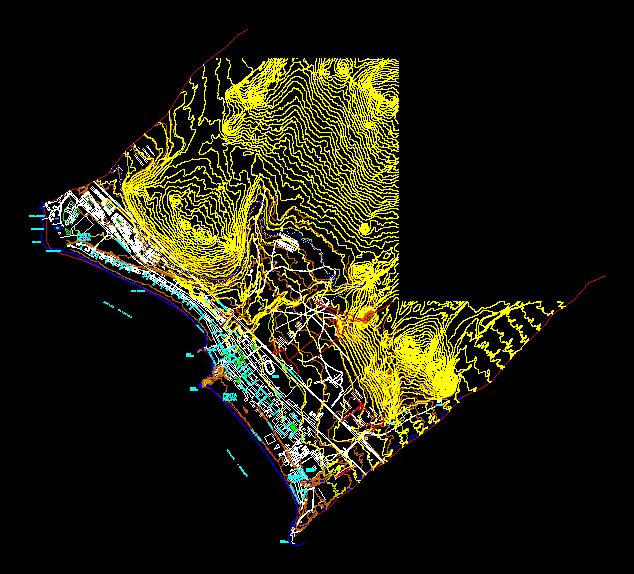
Planimetries LIMA – contour – profiles
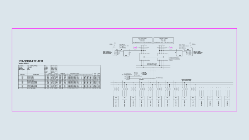
Drawing labels, details, and other text information extracted from the CAD file (Translated from Spanish):
punta negra, delfin, lima pucusana highway, swimming pool, caiman, lizard, crocodiles, eels, or c a a n o p a c i f i c o, playa el puerto, el sapo, av. pacific north, clams, erenques, walruses, mackerels, beach fishermen, black, tip, whales, sharks, octopus, rock point, beach ravine, beach la quebrada, ancient panamericana, cemetery, santa rosa, urban core, sedapal, recreation, center of, garcia noguera, manuel brescia, san marti de porres, bellavista street, m. angulo rojas, cascajal, gulls, cazon, anchoveta, av. gaunay south, the flamingos, the corals, the cheetah, the bufeo, playa el reves, the turtles, the bonito, j. ormeno, deposit, south panamerican highway, chanque, beach the bikini, av. alcatraz, the swans, av. pacific south, sea bass, algae, pimfret pampanito, pelicans, corvina, squid, san jose, echegaray, tuna, conchitas, squid, lorna, av. central, av. pacific north, pejerrey, corvina, crabs, black tip, giganton, northern malecon, penguins, sole, wolves, choros, cojinova, lima pucusana highway, the mercy, a. h., sardines, mismis, piranha, snail, hill watch, tank, water, hillocks tocto, or c a a n o p a c i f i c, av. guanay, brick