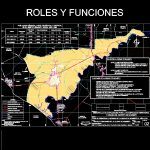
Roles And Functions Monsefu DWG Plan for AutoCAD
Urban development plan of the city of Monsefu 2015 – Roles and Functions.
Drawing labels, details, and other text information extracted from the CAD file (Translated from Spanish):
laran, drain, olives, cross laran, saint Louis, Saint Paul, callan, custodian, San Bartolome, transit laran, alican great, alican boy, transit traffic, big bridge, bridge requires, custodian, Alican, baccatoma, monsefu requester, glistens, high chandelier, pomape, San Juan, a.h. monsefu, beautiful valley, the carmen, pomape, mercy, micarcape, carob tree, the victory, cusure, calazan, wall, spit, farm, large ditch, poncho, jesus nazarene captive, santa catalina, pink puma, San Isidro, Santa Rita, muysil, Castile, San Rafael, san pedro, peasant community, tumbon, caffeine, tip, spit, wall, monsefu, Beach, main channel requires, rio require, main channel, acequia monsefu, acequia chacupe, pomarosa, pomape, yalcuchique, pomape, rio require, town, principal, channel, poncho, san pedro, I cum, rio require, peppermint, Saint Rose, wink, irrigation ditch, legend, affirmed road gauge, River, asphalt road, district capital city, populated center, defined limits, referential limires, drain, old road, Saint Rose, graphic scale, mt., km., drain, a.h. villa el sol, roles roles, district pomalca, district chiclayo, district monsefu, requires, eten, port, city eten, captive nazarene, monsefu, peasant community, san pedro de monsefu, pimentel road, monsefu road, peasant community, Saint Rose, district santa rosa, townhouse eten, district port eten, district pimentel, district victoria, Pacific Ocean, density, hab., rural population, hab., population, dist. monsefu, prov. Chiclayo, reg. lambayeque, urban population, total, surface, ambit, of the city of monsefude the city of monsefu in the metropolitan area. dynamiser of its district district complementary urban center of the metropolitan area of in the district scope. administrative policy of the city of, of the city of monsefude the city of monsefu of extraction of the agricultural activity center of the district. residential center of the district population. commercial artisanal goldsmith of the district. development of muchick culture. of the most important popular religiosity of the province. of concentration of the main tourist cultural resources of the province. center of traditional food outlets in the province. of the processing of goldsmith’s handicraft industry of the province., population census provincial district level, in rural urban area year, provider entity:, district municipality of monsefú, development of capacities for the urban territorial planning of the district of monsefú, study:, draft:, flat:, esc:, roles functions of the city of monsefu, sheet no, date:, research institute municipal training inicam, plan of urban development of the city of monsefú to the year, source: national institute of statistical informatics inei regional government of lambayeque technical team inicam coordinate system: universal transverse mercator, April
Raw text data extracted from CAD file:
Drawing labels, details, and other text information extracted from the CAD file (Translated from Spanish):
laran, drain, olives, cross laran, saint Louis, Saint Paul, callan, custodian, San Bartolome, transit laran, alican great, alican boy, transit traffic, big bridge, bridge requires, custodian, Alican, baccatoma, monsefu requester, glistens, high chandelier, pomape, San Juan, a.h. monsefu, beautiful valley, the carmen, pomape, mercy, micarcape, carob tree, the victory, cusure, calazan, wall, spit, farm, large ditch, poncho, jesus nazarene captive, santa catalina, pink puma, San Isidro, Santa Rita, muysil, Castile, San Rafael, san pedro, peasant community, tumbon, caffeine, tip, spit, wall, monsefu, Beach, main channel requires, rio require, main channel, acequia monsefu, acequia chacupe, pomarosa, pomape, yalcuchique, pomape, rio require, town, principal, channel, poncho, san pedro, I cum, rio require, peppermint, Saint Rose, wink, irrigation ditch, legend, affirmed road gauge, River, asphalt road, district capital city, populated center, defined limits, referential limires, drain, old road, Saint Rose, graphic scale, mt., km., drain, a.h. villa el sol, roles roles, district pomalca, district chiclayo, district monsefu, requires, eten, port, city eten, captive nazarene, monsefu, peasant community, san pedro de monsefu, pimentel road, monsefu road, peasant community, Saint Rose, district santa rosa, townhouse eten, district port eten, district pimentel, district victoria, Pacific Ocean, density, hab., rural population, hab., population, dist. monsefu, prov. Chiclayo, reg. lambayeque, urban population, total, surface, ambit, of the city of monsefude the city of monsefu in the metropolitan area. dynamiser of its district district complementary urban center of the metropolitan area of in the district scope. administrative policy of the city of, of the city of monsefude the city of monsefu extraction of the agricultural activity center of the district. residential center of the district population. commercial artisanal goldsmith of the district. development of muchick culture. of the most important popular religiosity of the province. of concentration of the main tourist cultural resources of the province. center of traditional food outlets in the province. of the processing of goldsmith’s handicraft industry of the province., population census provincial district level, in rural urban area year, provider entity:, district municipality of monsefú, development of capacities for the urban territorial planning of the district of monsefú, study:, draft:, flat:, esc:, roles functions of the city of monsefu, sheet no, date:, research institute municipal training inicam, plan of urban development of the city of monsefú to the year, source: national institute of statistical informatics inei regional government of lambayeque technical team inicam coordinate system: universal transverse mercator, April
Raw text data extracted from CAD file:
| Language | Spanish |
| Drawing Type | Plan |
| Category | City Plans |
| Additional Screenshots |
 |
| File Type | dwg |
| Materials | Other |
| Measurement Units | |
| Footprint Area | |
| Building Features | Car Parking Lot |
| Tags | autocad, beabsicht, borough level, city, development, DWG, functions, monsefu, plan, political map, politische landkarte, proposed urban, road design, stadtplanung, straßenplanung, urban, urban design, urban plan, zoning |
