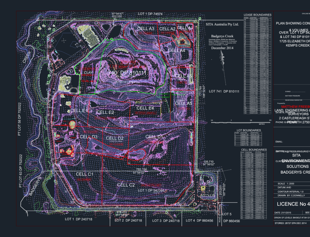
Site plan for the Badgerys Creek landfill facility at Kemps Creek. It’s a full volumetric and topographic survey covering Lot 740 and Lot 1. Includes 1m contour intervals and calculated volumes for cells A1 through E4, plus the big clay stockpiles. We’ve got Easting and Northing coordinate tables for all boundaries using AHD and MGA94 Zone 56. Total site is about 65 hectares, with 57ha dedicated to landfill. It was drawn up for an EPA report, so it’s got all the technical boundary data you’d expect. Aerial imagery background included for context.
SITA Badgerys Creek Landfill Site Survey with Contours & Volumes