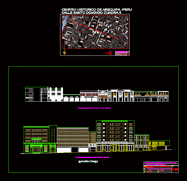
Survey Arequipa Peru Santo Domingo Street DWG Block for AutoCAD
architectural facades Lift the historical center of the city of Arequipa in Peru; historic monuments;colonial houses .
Drawing labels, details, and other text information extracted from the CAD file (Translated from Spanish):
street santo domingo sixth block straight, street santo domingo sixth left, esc:, stretch elevation, astoria, green Day, savory, carsa, funkifish, do it, coat, karaoke, archangel, proposal, faculty of unsa architecture, profile street santo domingo block street peru block, victor toledo s., drawing, draft, scale, flat, chair, date, may, sheet, architecture workshop, psje. Cathedral, church of, lodging house, the mercedes, psje, residential vallecito, psje. the Americas, tap, church, the mercy, portal san agustin, portal of the municipality, alvarez thomas, club, arequipa, colonial, church of, comdcia, p.n., Santo Domingo, duhamel park, sunat, galleries games, Gallery, flower portal, of the, company, the company, continental bank, cloisters, Bank, international, cinema, municipal, galleries, heresy, cial, panoramic, the great road, plaza espana, Mall, franky ricky, EC., m. to melt, bridge axis diagnosis, faculty of architecture urbanism, Location, draft, scale, flat, it varies, chair, date, April, sheet, san agustin national university, left profile, right profile, legend, historical center of arequipa street santo domingo block
Raw text data extracted from CAD file:
| Language | Spanish |
| Drawing Type | Block |
| Category | City Plans |
| Additional Screenshots |
 |
| File Type | dwg |
| Materials | |
| Measurement Units | |
| Footprint Area | |
| Building Features | Car Parking Lot, Garden / Park |
| Tags | architectural, arequipa, autocad, beabsicht, block, borough level, center, city, domingo, DWG, facades, historic, historical, lift, PERU, political map, politische landkarte, proposed urban, road design, santo, stadtplanung, straßenplanung, street, survey, urban design, urban plan, zoning |
