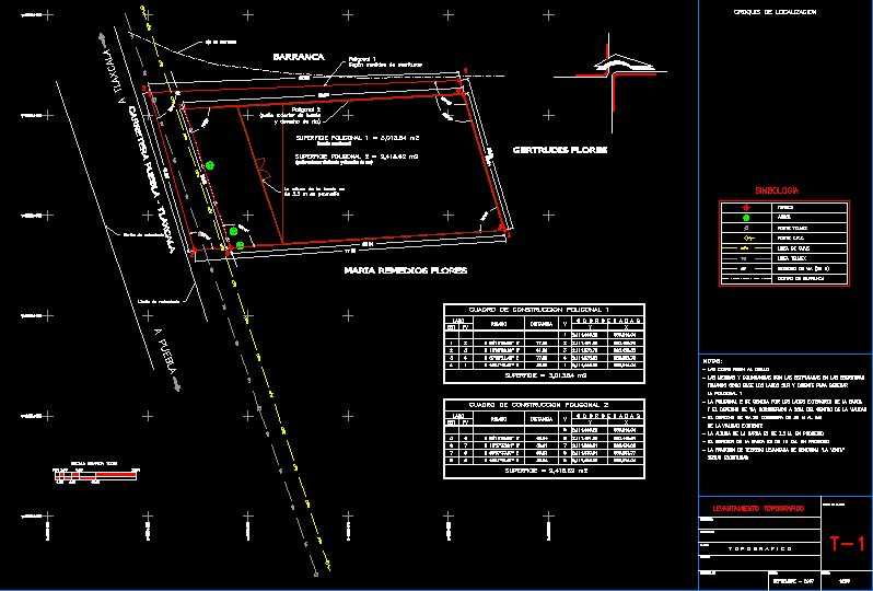
File is a drawing showing a survey planimetry, with all topographic elements and can serve as a basis for other work.
Drawing labels, details, and other text information extracted from the CAD file (Translated from Spanish):
topographic survey, topographic, plan :, aprobo :, development :, date :, location :, property :, scale :, plan key :, – the dimensions apply to the drawing, notes :, cfe post, tree, vertex, simbology, post telmex, a puebla, canyon, gertrudis flowers, maria flower remedies, road puebla – tlaxcala, a tlaxcala, location sketch, cfe line, telmex line, canyon center, – the measures and adjoining are stipulated in the scriptures, taking as a base the south and east sides to generate, from the existing road, side, coordinates, distance, course, est, canyon axis, bearing limit, according to the deeds