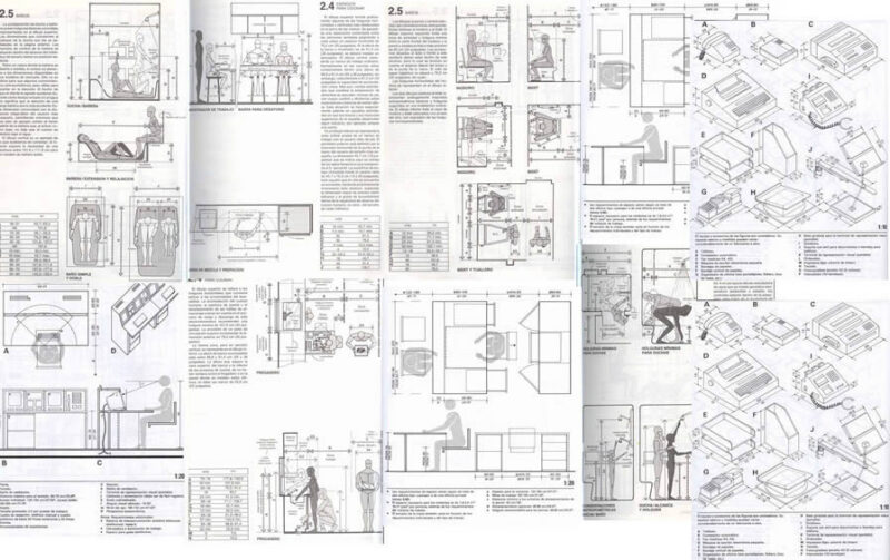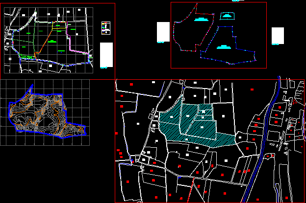
PLANE SURVEY
Drawing labels, details, and other text information extracted from the CAD file (Translated from Spanish):
esq, road, est, pto, cur, grape, esqinlot, post, post-light, path, track, pist, well, viv., c.p. thrown, owned by third parties, hill, asphalt runway, irrigation channel, const. exist., mud wall, house, brick wall, wells, concrete floors, road, prefabricated fence, shed, water well, fence of mats, mill tower, hollows, channel, stable, adobe wall, vertice, side, distance , ang. internal, ab, bc, cd, of, ef, fg, gh, hi, ij, jk, kl, lm, mn, no, op, pq, qr, rs, st, you, uv, vw, wx, xy, yz, total, booth, well, legend, unpaved runway, brick wall, brick wall, asparagus area, fallen grape, grape area, casuarinas, tree, perimeter fence, stake, hawthorn, land division plan, divided plans, fa , district: ica province: ica department: ica, investments centenario sa, drawing:, date:, scale:, location:, owner:, project:, map:, topography :, perimeter survey, pmt, seea, castle property brigas pedro , planimetry – contour lines