Help on GoFundMe

ADVERTISEMENT

ADVERTISEMENT

Topographic Map DWG Block for AutoCAD

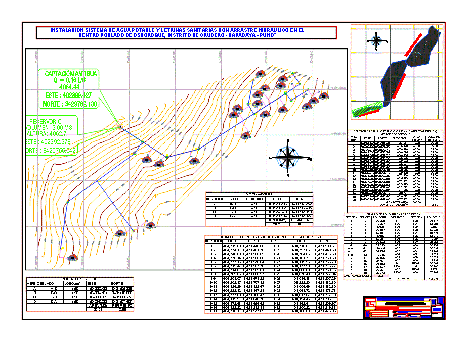
SURVEYING WATER TOPOGRAPHIC MAP

Drawing labels, details, and other text information extracted from the CAD file (Translated from Spanish):

old catchment, reservoir, district municipality of cruise, scale:, date:, location:, cruise district – carabaya – puno, laminate:, dept .:, district:, province:, location plan, sector:

Raw text data extracted from CAD file:

Language Spanish
Drawing Type Block
Category
Additional Screenshots
File Type dwg
Materials Other
Measurement Units Metric
Footprint Area
Building Features
Tags , , , , , ,

ADVERTISEMENT

Plans_Designs

Leave a Reply

ADVERTISEMENT