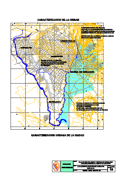
Topographic Map Of The District’s Band Shilcayo – Tarapoto Peru DWG Block for AutoCAD
Characterization of-band urban Shilcayo – department of San Martin Tarapoto – Peru
Drawing labels, details, and other text information extracted from the CAD file (Translated from Spanish):
moral, shilcayo band, tarapoto, shilcayo river, broken choclino, low threatened by floods urban expansion zone towards the avoidance route. there is constant contamination from the outlet of the main drain manifold., invasion of private property by low-income families occupying even steep slopes. possible deterioration of existing flora in the depressions of the choclino ravine dump of waste waters, high danger in the basin of the river shilcayo in times of increasing. water contaminated by discharge of drains., sustainable cities, land use plan disaster mitigation measures of the city of tarapoto, new, study:, sheet, scale, indeci, flat, urban characterization shilcayo band, characterization of the city, urban characterization of the city
Raw text data extracted from CAD file:
| Language | Spanish |
| Drawing Type | Block |
| Category | City Plans |
| Additional Screenshots | Missing Attachment |
| File Type | dwg |
| Materials | |
| Measurement Units | |
| Footprint Area | |
| Building Features | Car Parking Lot |
| Tags | autocad, band, beabsicht, block, borough level, department, district, DWG, map, martin, PERU, political map, politische landkarte, proposed urban, road design, san, stadtplanung, straßenplanung, tarapoto, topographic, urban, urban design, urban plan, zoning |
