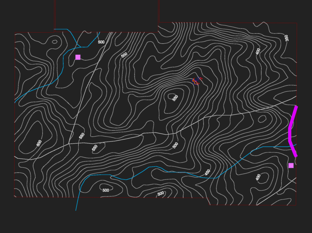
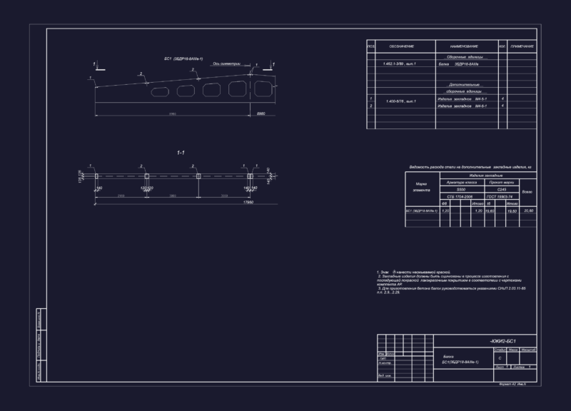
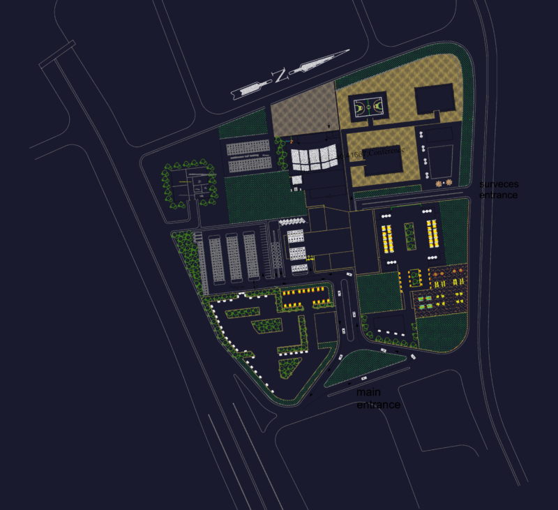
This drawing is for a topographic map of the Pedreira Bolandeira Norte mining site, including contour lines and progress of the excavation fronts. Schematic 3D models of the 2017-2020 mining faces are included and could be useful in mining site planning or environmental reports.
Amex Mining Site Topographic Map and Excavation Front Progress