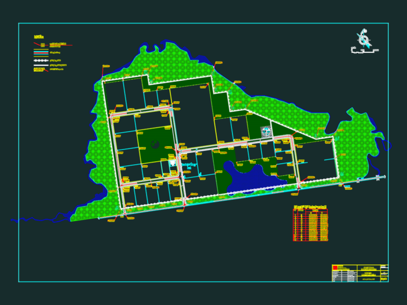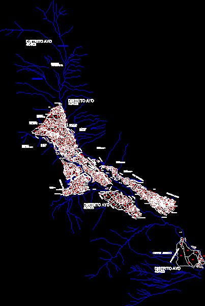
Base with coordinates utm of Ayo – Arequipa
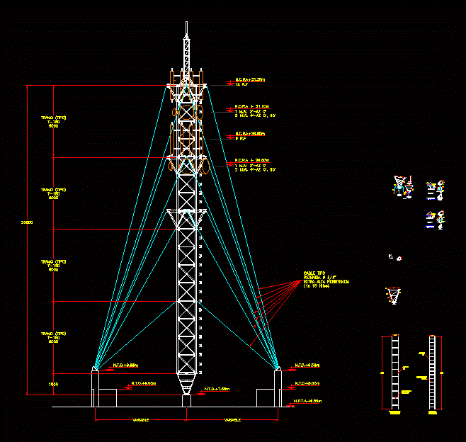
Drawing labels, details, and other text information extracted from the CAD file (Translated from Spanish):
z.l, eriazo, z.u., eriazo, z.u., eriazo, z.u., eriazo, house huerta, z.u., mountain, z.urb., eriazo, forest, path, eriazo, forest, eriazo, ravine, path, eriazo, ravine, eriazo, ravine, z.u., urb., zone, eriazo, ccotocahuana, Hill, arborea cover, eriazo, highway, path, eriazo, ravine, eriazo, anta sector, abandoned, soothing, Hill, eroded, Hill, eriazo, abandoned, eriazo, abandoned, eriazo, abandoned, eriazo, abandoned, silo, ravine, silo, z.u., eriazo, hillside, eriazo, ccotocahuana, Hill, ccotocahuana, Hill, ccotocahuana, Hill, abandoned, sector utme, ravine, abandoned, eriazo, ravine, eriazo, ravine, abandoned, ravine, paccha sector, ravine, eriazo, abandoned, ravine, eriazo, abandoned, eriazo, z.u., z.urb., z.u., village sector, eriazo, arborea, coverage, z.u., z.urb., church, z.u., z.urb., z.u., urban zone, z.u., urban, zone, urban zone, z.u., z.urb., eriazo, z.u., eriazo, broken sillo, red hill, district ayo, tunupacha, sector, abandoned, abandoned land, barn, forest area, ravine, eriazo, oviedo, sector, aguirre, sector, orawasi, Hill, collo, nose, I think, annexed, molinoyoc, nose, district ayo, district ayo, eriazo, big broken, eriazo, urban, zone, eriazo, abandoned, eriazo, hill collo, eriazo, abandoned, eriazo, abandoned ground, eriazo, district ayo, Pumacocha sector, hill jencho, town, irrigation ditch, waterproof, irrigation ditch, pond, waterproof, old, pond, irrigation ditch