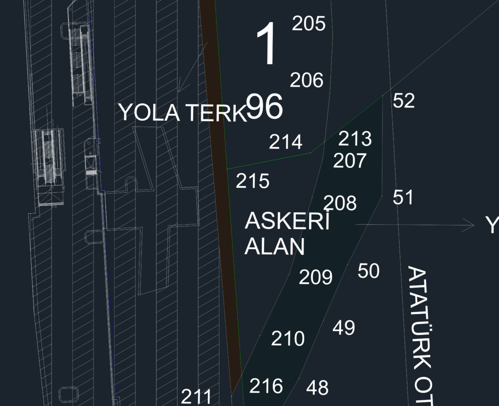
Detaied city map for the Atatürk Otosanayi station surroundings. Covers existing metro lines, cadastral borders, and designated military zones or park areas. Scale 1/2000, everything’s labeled in Turkish. atatürk Otosanayi İstasyonu ve çevresine ait plan. Mevcut metro hattı, park ve askeri alan sınırlarını içerir.
City plan for Atatürk Otosanayi Station area including metro lines