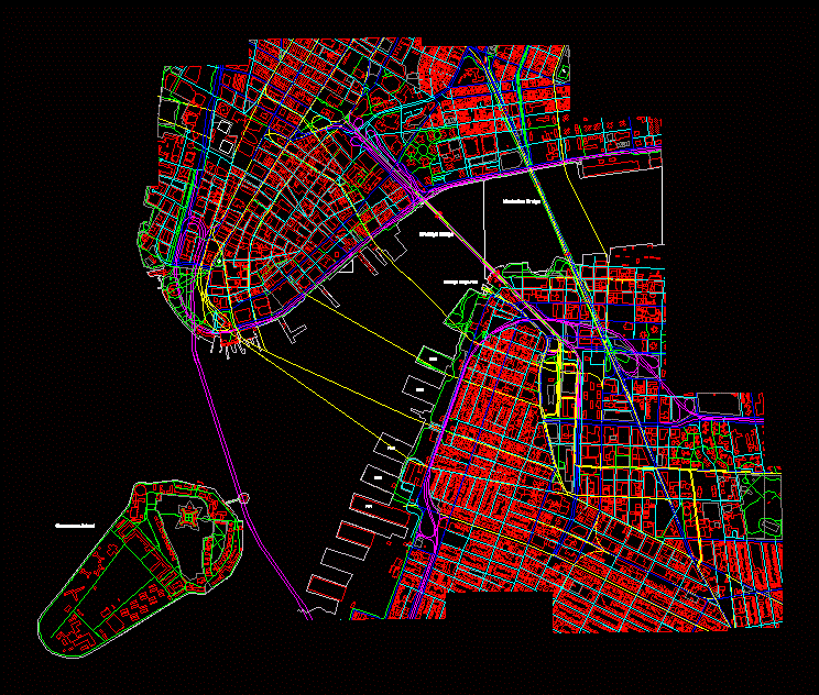
This is a map made on autocad based on OpenMapStreet map. The area covered the financial district of manhattan and the brooklyn bridge park walk with some streets neighborood behind.
Drawing labels, details, and other text information extracted from the CAD file:
manhattan bridge, brooklyn bridge, brooklyn bridge park, pier, governors island