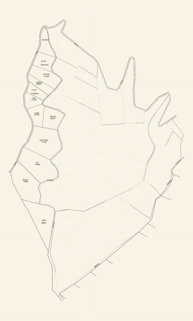
Land redistribution site plan for the Banjarwangi & Mulyajaya regions derived from 2020 survey datasets. Parcels are mapped with closed LWPOLYLINES for area takeoff, with calculated areas (L=) noted in m2 directly in the drawing text. Layout includes existing secondary drainage (selokan), road networks (jalan), and forestry (kehutanan) boundaries. I’ve categorized larger HGU (Hak Guna Usaha) plots alongside smaller residential and agricultural lots. While the CAD environment is set to Imperial units, the on-drawing annotations follow metric cadastral standards used for local land tnure projects. Proper layer management is used for parcel boundaries (LB_LAI) and owner names (tn_nama) to assist in site planning or civil dev
Agricultural Land Parcel Map showing Drainage and Road Layout